Great Sand Dunes National Park: Nature's Mysterious Medley
A snow-capped mountain range, a green valley, a meandering stream, the sun rising or setting behind the mountains, a few birds flying amidst the blue of the sky, the perfect landscape picture from your childhood drawing books. But I can bet that you never thought of drawing a desert in the midst of all this even with your wildest childish imagination. Well, I know someone who did, the most magnificent and probably the craziest artist, Nature. It is hard to believe that such a place exists until you have witnessed it at the Great Sand Dunes National Park.

I had read about the place and seen several photos while planning our visit, therefore got excited at the very first glance of snow-capped peaks of Sangre de Cristo Range at a distance as we drove on Highway 150.

Soon the dunes became visible at the far end of the grasslands of San Luis Valley as we entered the park area.

When we came close enough we saw the Medano Creek. Yes, a slow flowing stream cuddling the foot of the dunes and the mountain. I do not have words to explain the strange beauty of the place, the ultimate contrasts of that enchanting sight.

The shadow of the clouds on the gigantic heaps of sand formed numerous changing patterns. The Medano creek spread into a wide stream at the base of the dune.

One has to cross this creek on foot to access the dunes. The water was almost knee high in early June. Midway into the stream I stopped at one of the sand ridges and looked around me. It felt like I was standing at the junction of two entirely different worlds, completely contradictory in character yet equally captivating.


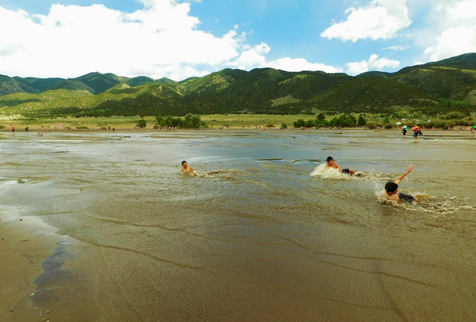
An interesting fact about this creek is that although being a slow moving stream it has an exciting feature, the 'surge-flow'. The underwater sand ridges build up and break down in about every twenty seconds sending down a wave. The playful children enjoy a lot at the natural beach as they are drifted by the waves and rolled in the sand.

We too had great fun trying of hold on to our hats and caps with one hand (as it was extremely windy), carrying our shoes in the other and yet trying to pose for photos and trying to capture the splendor for our surroundings.

(Click here to know more about the condition of the creek throughout the year.)
The temperatures were quite pleasant, but as I metioned before it was extremely windy. This is very typical of this place. People were enjoying sand boarding and sand sledding on the dunes. Strong winds pelted the sand on us as we hiked the dunes. This brings me to the geological explanation for the formation of the dunes in this unlikely place.


Trivia on the formation of dunes:
Rio Grande river and its tributaries flow through the San Luis Valley and deposit sand and soil on the river flood plain. Over the years the glacier melted and waters of a big lake in this area evaporated leaving behind more debris. The westerly winds carried these particles from the flood plains but lost power before crossing the Sangre de Cristo Range and sand was deposited on the east edge of the valley. This process still continues, making the dunes grow slowly.

As the sun started to set behind the mountains we started to pack up and were soon on the road again headed to our next destination. Yet we could not help turning around our heads to relish a few more glances of that mesmerizing sight with silent promises to come back again.


Location: Rocky Mountains, Colorado, U.S.A
Elevation: 2308m to 4146m
Main Attractions: Tallest sand dunes in North America (about 230m), Medano Creek
Nearest City: Alamosa
I had read about the place and seen several photos while planning our visit, therefore got excited at the very first glance of snow-capped peaks of Sangre de Cristo Range at a distance as we drove on Highway 150.

Soon the dunes became visible at the far end of the grasslands of San Luis Valley as we entered the park area.

When we came close enough we saw the Medano Creek. Yes, a slow flowing stream cuddling the foot of the dunes and the mountain. I do not have words to explain the strange beauty of the place, the ultimate contrasts of that enchanting sight.

The shadow of the clouds on the gigantic heaps of sand formed numerous changing patterns. The Medano creek spread into a wide stream at the base of the dune.

One has to cross this creek on foot to access the dunes. The water was almost knee high in early June. Midway into the stream I stopped at one of the sand ridges and looked around me. It felt like I was standing at the junction of two entirely different worlds, completely contradictory in character yet equally captivating.


An interesting fact about this creek is that although being a slow moving stream it has an exciting feature, the 'surge-flow'. The underwater sand ridges build up and break down in about every twenty seconds sending down a wave. The playful children enjoy a lot at the natural beach as they are drifted by the waves and rolled in the sand.

(Click here to know more about the condition of the creek throughout the year.)
The temperatures were quite pleasant, but as I metioned before it was extremely windy. This is very typical of this place. People were enjoying sand boarding and sand sledding on the dunes. Strong winds pelted the sand on us as we hiked the dunes. This brings me to the geological explanation for the formation of the dunes in this unlikely place.


Trivia on the formation of dunes:
Rio Grande river and its tributaries flow through the San Luis Valley and deposit sand and soil on the river flood plain. Over the years the glacier melted and waters of a big lake in this area evaporated leaving behind more debris. The westerly winds carried these particles from the flood plains but lost power before crossing the Sangre de Cristo Range and sand was deposited on the east edge of the valley. This process still continues, making the dunes grow slowly.

As the sun started to set behind the mountains we started to pack up and were soon on the road again headed to our next destination. Yet we could not help turning around our heads to relish a few more glances of that mesmerizing sight with silent promises to come back again.


Comments
Post a Comment